


Valley Precinct, Madison County, Nebraska
About
Outline

Summary
| Unique Area Identifier | 613604 |
| Name | Valley Precinct |
| County | Madison County |
| State | Nebraska |
| Area (square miles) | 45.04 |
| Land Area (square miles) | 44.46 |
| Water Area (square miles) | 0.58 |
| % of Land Area | 98.71 |
| % of Water Area | 1.29 |
| Latitude of the Internal Point | 42.04912580 |
| Longtitude of the Internal Point | -97.52552120 |
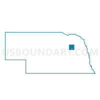
Maps

Graphs
Select a template below for downloading or customizing gragh for Valley Precinct, Madison County, Nebraska


Neighbors
Neighoring Voting District (by Name) Neighboring Voting District on the Map
- BC-Battle Creek Precinct, Madison County, NE
- Hadar Area/South Branch Precinct, Pierce County, NE
- Meadow Grove-Jefferson-Grove-Highland Precinct, Madison County, NE
- Norfolk 1-3 Precinct, Madison County, NE
- Norfolk 2-1 Precinct, Madison County, NE
- Norfolk 2-2 Precinct, Madison County, NE
- Norfolk 2-3 Precinct, Madison County, NE
- Norfolk Precinct, Madison County, NE
- Pierce Rural Area Precinct, Pierce County, NE
- Warnerville Precinct, Madison County, NE
Top 10 Neighboring County Subdivision (by Population) Neighboring County Subdivision on the Map
- Norfolk city, Madison County, NE (24,210)
- Norfolk precinct, Madison County, NE (1,581)
- Battle Creek precinct, Madison County, NE (1,165)
- Valley precinct, Madison County, NE (1,007)
- South Branch precinct, Pierce County, NE (725)
- Meadow Grove-Jefferson precinct, Madison County, NE (673)
- Warnerville precinct, Madison County, NE (400)
- Cleveland precinct, Pierce County, NE (265)
- Blaine precinct, Pierce County, NE (80)
Top 10 Neighboring Place (by Population) Neighboring Place on the Map
Top 10 Neighboring Unified School District (by Population) Neighboring Unified School District on the Map
- Norfolk Public Schools, NE (29,772)
- Pierce Public Schools, NE (3,747)
- Battle Creek Public Schools, NE (2,573)
Top 10 Neighboring State Legislative District Upper Chamber (by Population) Neighboring State Legislative District Upper Chamber on the Map
Top 10 Neighboring 111th Congressional District (by Population) Neighboring 111th Congressional District on the Map
Top 10 Neighboring Census Tract (by Population) Neighboring Census Tract on the Map
- Census Tract 9608.01, Madison County, NE (4,787)
- Census Tract 9791, Pierce County, NE (3,826)
- Census Tract 9612, Madison County, NE (3,513)
- Census Tract 9792, Pierce County, NE (3,440)
- Census Tract 9608.02, Madison County, NE (3,289)
- Census Tract 9607, Madison County, NE (3,237)
- Census Tract 9611, Madison County, NE (1,869)